July 29, 2026
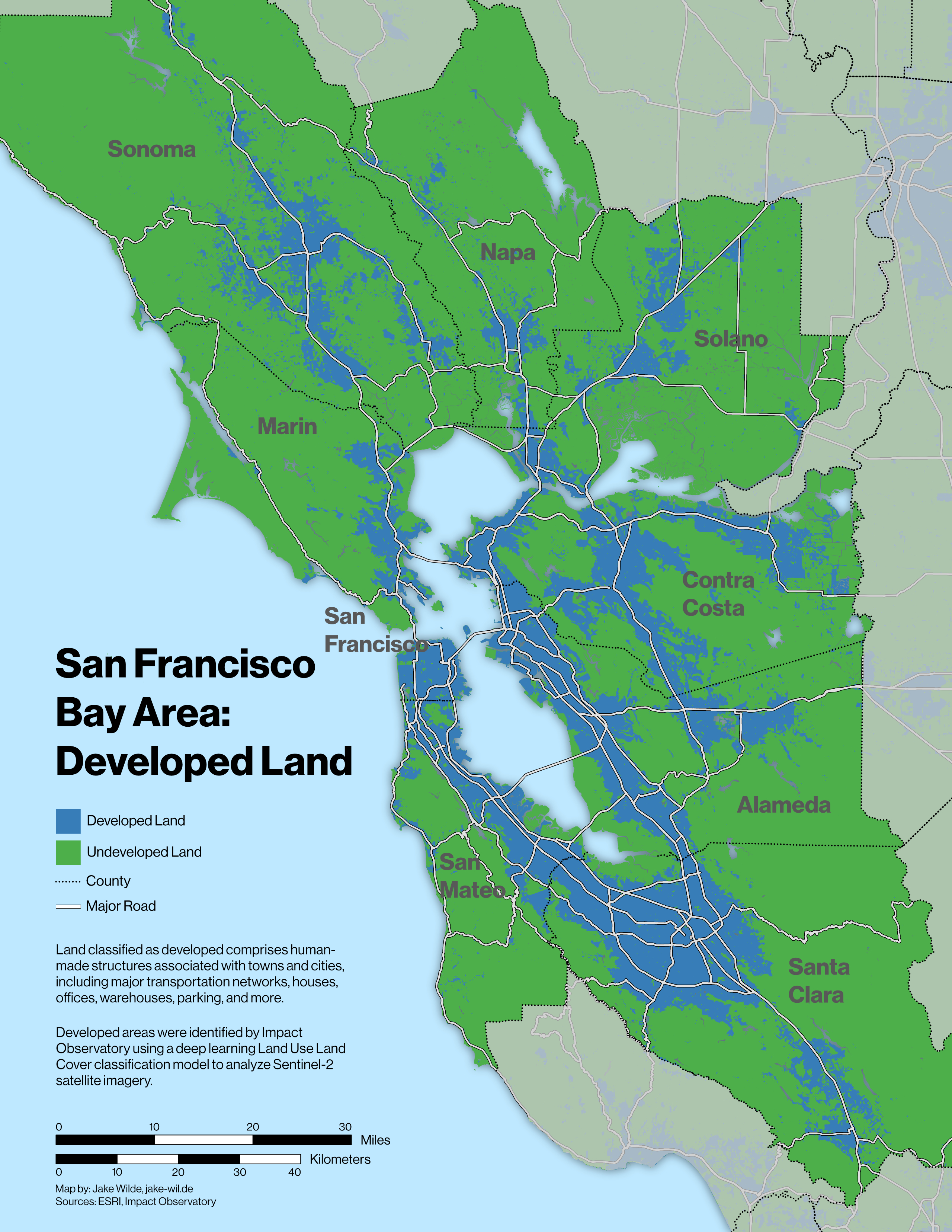
This map presents the developed footprint of the nine-county Bay Area.
Land classified as developed comprises human-made structures associated with towns and cities, including major transportation networks, houses, offices, warehouses, parking, and more.
Developed areas were identified by Impact Observatory using a deep learning Land Use Land Cover classification model to analyze Sentinel-2 satellite imagery.